Save Old Farm Park campaigners announced some time ago that they would be looking to increase the park’s wildlife value whether the sell-off of the eastern half by Bexley Council went ahead or not. We can report that some initial plans have now been sketched out, and these will be worked up in a bit more detail prior to wider consultation.
Also this week, it has emerged that the 12m strip of Old Farm Park (east) – measuring from the railway fence line – that Cllr. Peter Craske confirmed at the full Council meeting would be excluded from the now-approved sale, is less than half that required to encompass the whole of the copses which are the reason a strip of land here was recommended by the London Wildlife Trust for inclusion in the Sidcup rail linesides Site of Importance for Nature Conservation. 28m would in fact be needed. Bexley Natural Environment Forum has today written to Cllr. Craske (see copy of letter below) pointing out that previous Council statements have given the impression that it was protecting the area recommended for SINC status, which appears to not now be the case, and to ask for an explanation as to the obvious mismatch between the citation text and the mapping.
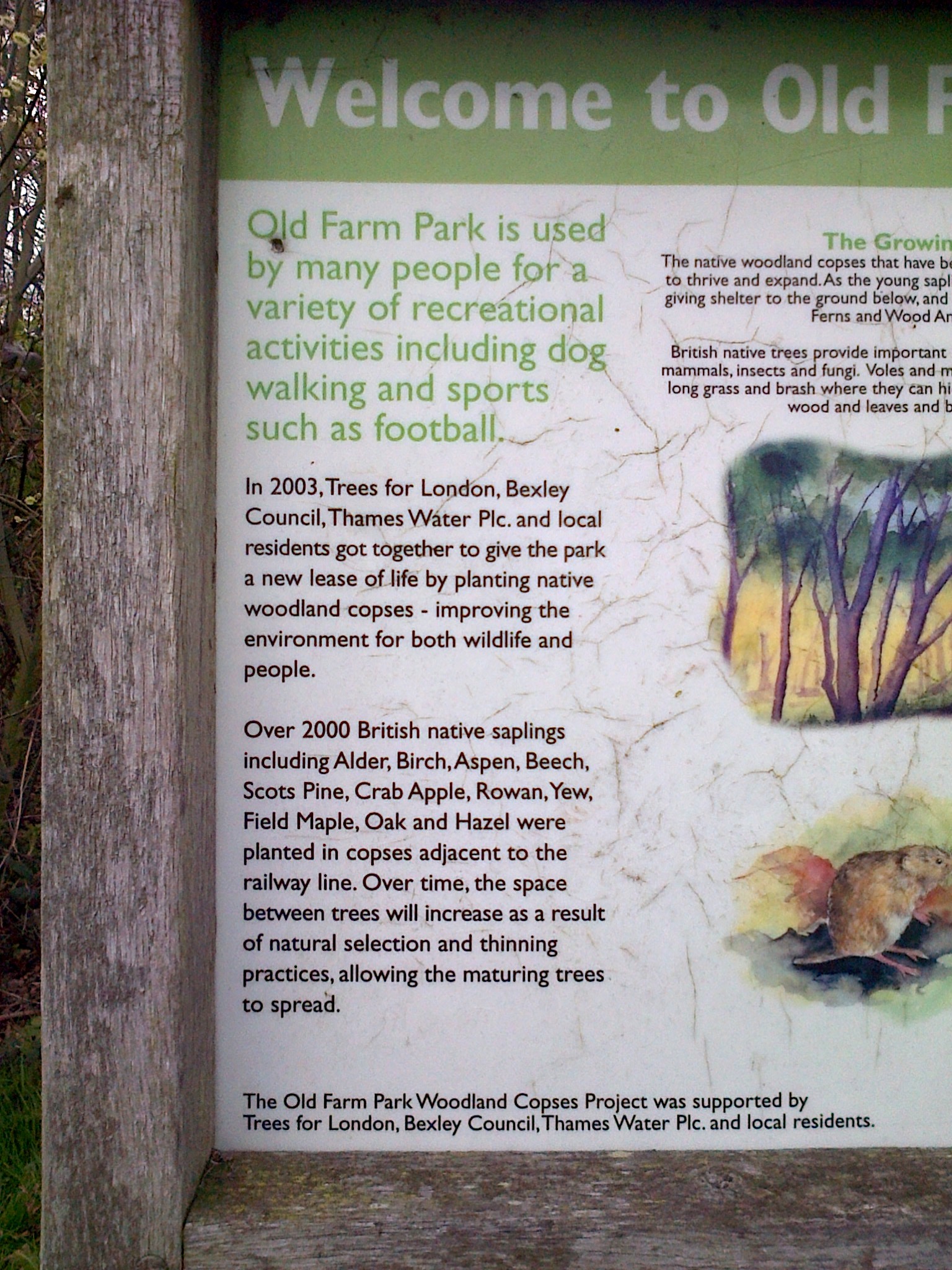
Signage in the park trumpets Bexley Council’s partnership in planting these copses only 13 years ago.
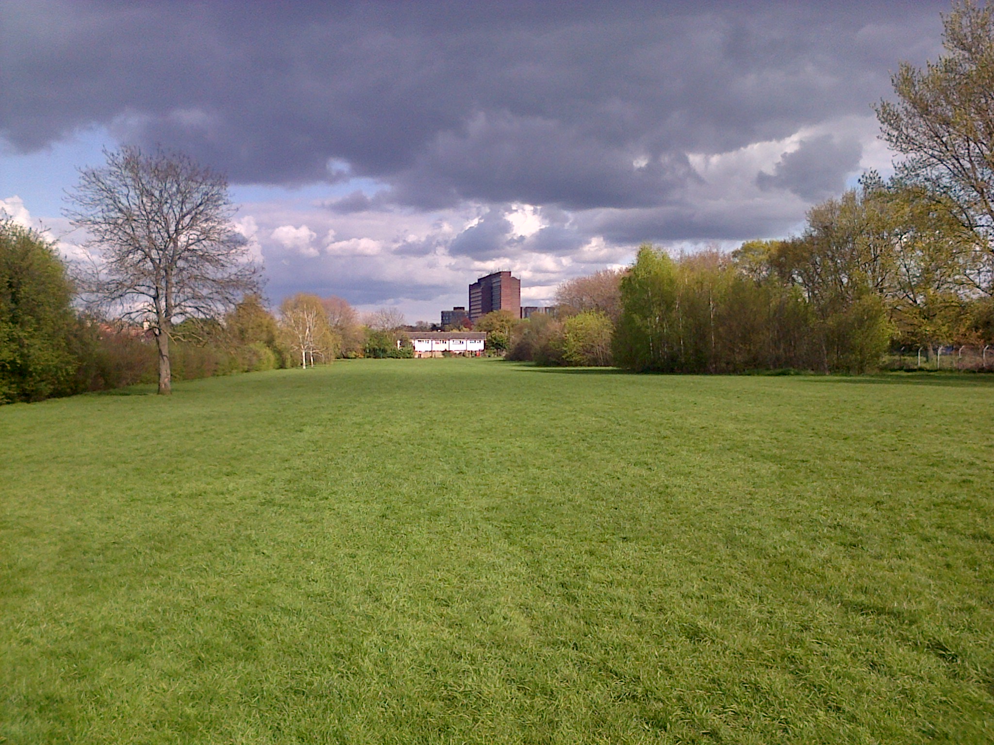
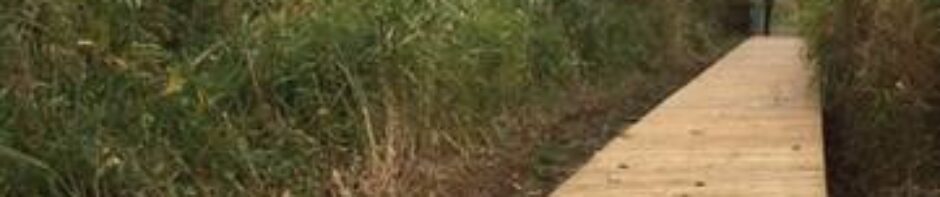
Dark clouds gather over the east end of Old Farm Park in Sidcup, which Bexley Council has now agreed to sell for ‘development’. At risk is the fine hedgerow along the left side, and a half slice of all the copses to the right, despite the Council having implied that these would be spared. (Photo: Chris Rose)
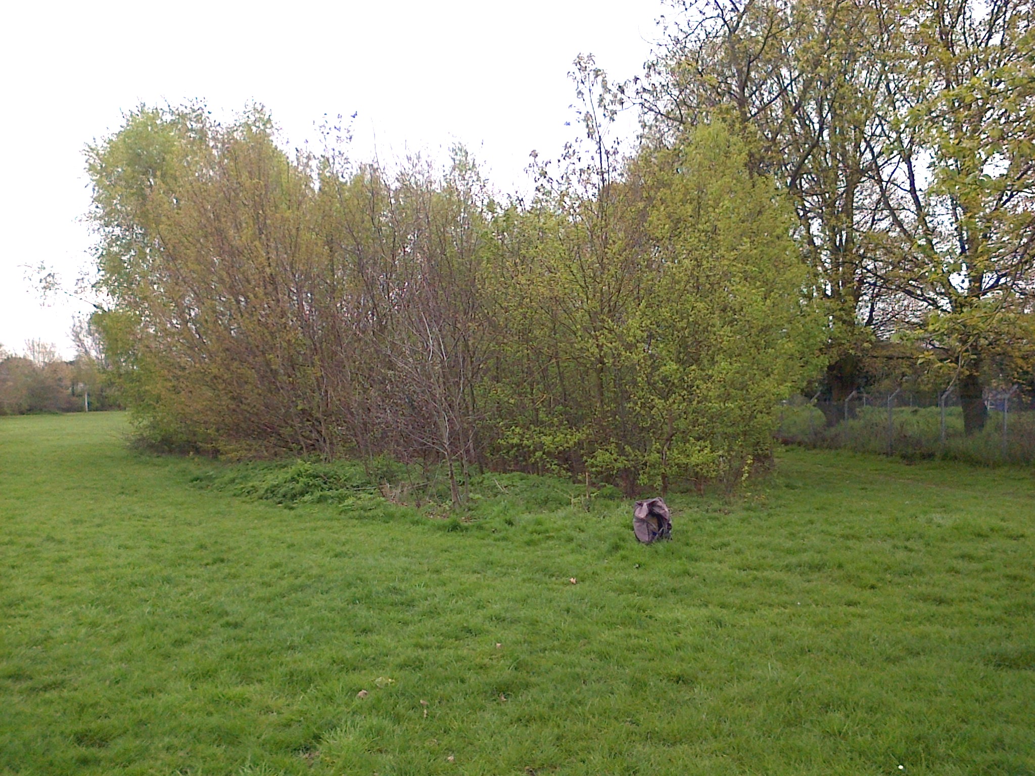
Cllr. Peter Craske has publicly stated that a strip of the east end of the park will not be sold, measuring 12m from the railway fence to the right. The 12m point is marked by the bag, so the copse will be split in half unless the conditions attached to any planning permission require it to be left intact, which seems unlikely. (Photo: Chris Rose)
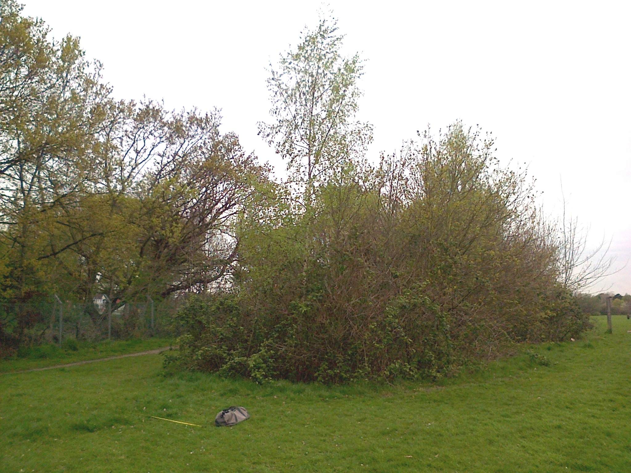
The bag again marks the line between what the Council says it will keep, and what it says it will sell. Again half the copse will go. This time the railway fence is to the left. (Photo: Chris Rose)
Meanwhile, residents turned out again yesterday morning, as the UKIP London Mayoral candidate followed those from the Conservative and Labour parties, to put forward his ideas on how to stop further loss of such green spaces in London. An ITN camera crew came, but word on the street is that the Guardian newspaper reporter appears to have got no further than meeting the UKIP people in a cafe near Sidcup railway station, rather than coming to the park itself.
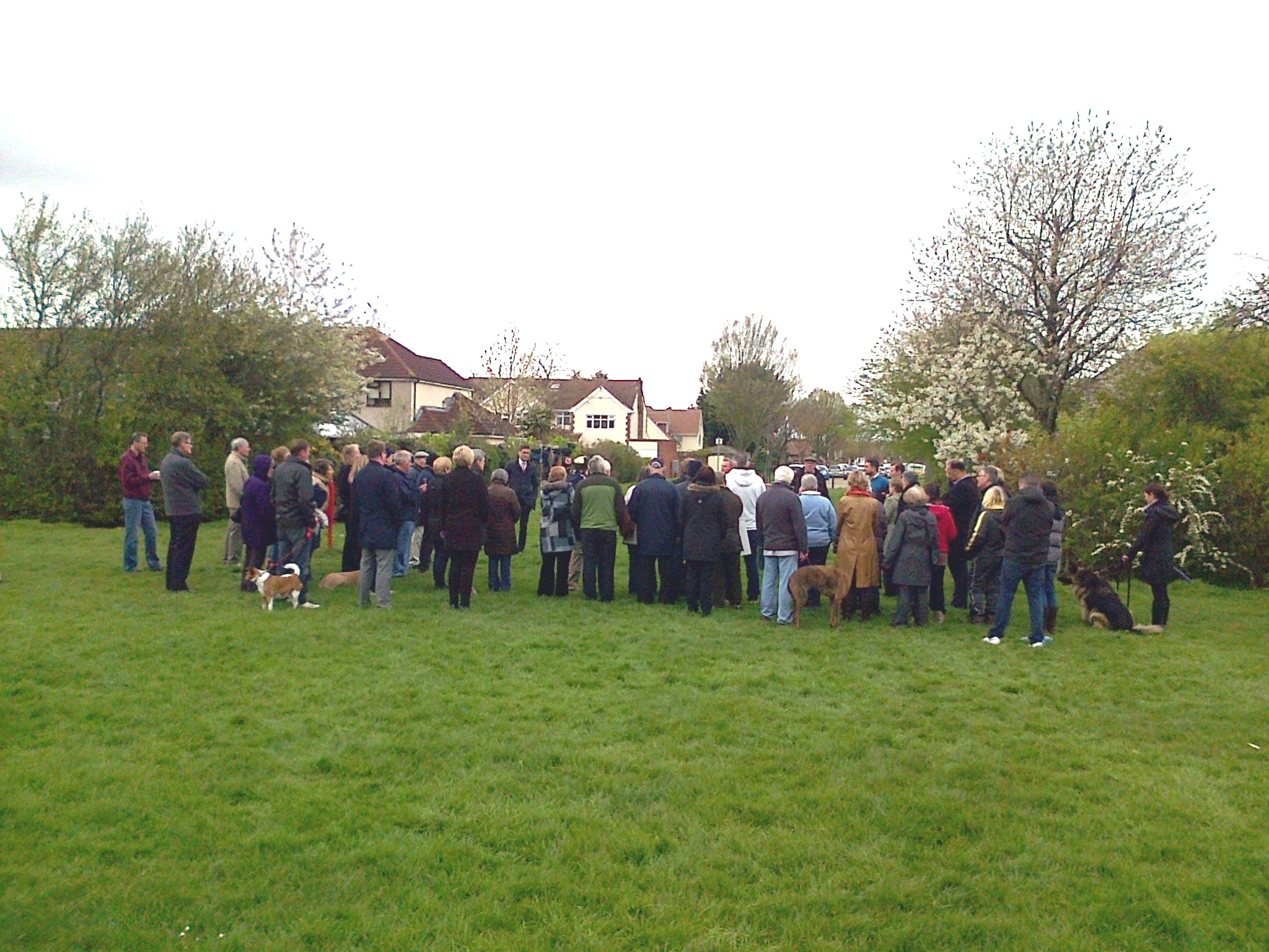
Residents hear what the UKIP London Mayoral candidate has to say about protection of green spaces. (Photo: Chris Rose)
Bexley Natural Environment Forum letter to Cllr. Peter Craske, Cabinet Member for Community Safety, Environment and Leisure, about the mismatch between the SINC mapping and 12m retained strip, and the cited copses for which the SINC designation was recommended.
Tue, April 26, 2016 2:05 pm
To: “Councillor Craske, Peter” Peter.Craske@bexley.gov.uk
Cc: “Gillian” <grayplace52@hotmail.com> (Chair, BNEF)
“Councillor Slaughter, June” <june.slaughter@bexley.gov.uk>
councillor.rob.leitch@bexley.gov.uk
lynn.smith@bexley.gov.uk
“Councillor Seymour, Melvin” Melvin.Seymour@bexley.gov.uk
Dear Cllr Craske,
The Council has previously indicated that the strip of Old Farm Park(east) along the railway line, recommended for inclusion in the Sidcup rail linesides SINC, would be withdrawn from the sale plot. I think it safe to say that this will have given the impression that the features highlighted in the draft SINC review document text as warranting this designation, namely the planted copses, would be protected from ‘development’.
Indeed it is clear from that document, unless one wants to play semantic games, that what was intended by the authors was the whole of those copses:
‘Parallel to the railway is the Old Farm Park with a stretch of planted scrub and woodland. The area is planted with native tree species: ash (Fraxinus excelsior), alder (Alnus glutinosa), field maple (Acer campestre), pedunculate oak (Quercus robur), silver birch (Betula pendula), beech (Fagus sylvatica), wild cherry (Prunus avium). Scrub layer is species rich and includes elder (Sambucus nigra), hawthorn (Crataegus monogyna), hazel (Corylus avellana), holly (Ilex aquifolium), dog rose (Rosa canina) and bramble (Rubus fruticosus agg). The planted stretch creates a continuous habitat with the overgrown hawthorn and wild cherry hedge along the railway fence. It provides excellent habitat for birds and functions as a natural extension of the habitat along the railways. Therefore it should be included in the SINC.’
Furthermore, signage in the park trumpets the fact that Bexley Council was a partner in planting those copses as recently as 2003, and for the benefit of wildlife.
Bexley Council now seems to have approved the loss of half a run of copses it was instrumental in getting planted. (Photo: Chris Rose)
At the full Council meeting last week you stated that the excluded area would extend to 12m from the railway fence line. Yesterday I took a tape measure to the park and measured that 12m. That is only enough to encompass the southern half of each copse. Since they are not very deep anyway, this will make a mockery of any idea that they are somehow being protected. Slicing them in half in this way is likely to negatively impact the remaining parts through root damage, hydrological effects and, depending in the design of the development, may result in pressure for cutting back if they are then very close to buildings and causing shading or damage to walls etc. My measurements suggest that you would need to leave a strip of about 28m to protect the entirety of the copses, and even then they would be right up against the boundary of the ‘development’.
Do you agree that the SINC review citation text relating to OFP makes it clear that LWT’s professional view was that the copses should be wholly included within the SINC boundary, and that 12m makes a mockery of any claim that the copses – and thus the part of the part recommended for SINC status, are actually being protected?
Was your statement about 12m an error, or is this the definite width?
This brings me onto a further aspect of the SINC boundary issue, which is the mapping in the SINC review document itself (which carries Bexley Council’s name and crest prominently on the front cover). A basic examination of the document shows that the strip mapped for addition is only about one fifth the width of the park, whereas from Google Earth it’s clear that the canopy of the copses extends to almost half the width of the park in summer.
Can you please
i) explain why there is this obvious mismatch between what the text says and what the mapping says (and whether the mapping represents 12m)
ii) tell us whether LWT is aware of this mismatch and if so, what view they relayed to Bexley Council about that, and if the matter was debated between the two organisations in some way, how the decision was reached and in what documentation this is minuted.
iii) if the mismatch is an error, tell us who is ultimately responsible for this mapping – LWT or Bexley Council
As you may be aware we have another supposed error in SINC mapping at Crayford Rough where the Council is claiming – to the benefit of developers – that, contrary to what is in the publicly available SINC documentation, 10% of the site is not within the SINC boundary.
Had the Council had a proper two-way dialogue with stakeholders throughout the SINC process, particularly in respect of examining the final draft and dealing openly with any disagreements, errors or omissions therein, and any amendments the Council wanted to make (which we believe the London Wildlife Sites Board guidelines mean should have happened), then these issues might have been caught earlier. I’m sure you’ll agree that what we need is public confidence in the mapping of all of our SINCs, that they have been drawn up according to the objective and professional advice of wildlife surveyors and will not be subject to the vagaries of errors or obscure or yet to be agreed agendas, strategies or particular planning proposals. There is a danger here that the perception could easily be otherwise.
We also note the long hedgerow along the rear of the properties to the north side of the eastern part of the park (there is no equivalent in the western part). This is a good height, twiggy, deciduous hedge of the sort favoured by House Sparrows, a bird now on the British red list due to a major decline in numbers. Indeed there were several birds in it when I looked. We hear a lot about the need for ‘green infrastructure’ in new ‘developments’, so is it the Council’s intention that this be retained in any new ‘development’, or bulldozed?
Yours sincerely, Chris Rose. Vice-chair, Bexley Natural Environment Forum.