
For what will have long been considered a fairly inconsequential piece of ground on the road from Erith and Slade Green to Dartford, Thames Road Wetland has generated an interesting, if somewhat limited legacy of photographs that pre-date the wetland creation. The earliest is a aerial photograph from July 1928, where the site can be seen in the distance, followed by a 1940 aerial image now on Google Earth. A ground level photograph taken in April 1983 by Ray Gray has just come to light. This is presented along with a photograph taken today (March 3rd) from a similar viewpoint, and another from 2006 just before the site was re-modelled to create the wildlife-rich wetland it is now.

The east end of what, some 23 years later, was to become Thames Road Wetland . April 1983. (Photo: Ray Gray. Kindly scanned by Michael Heath).
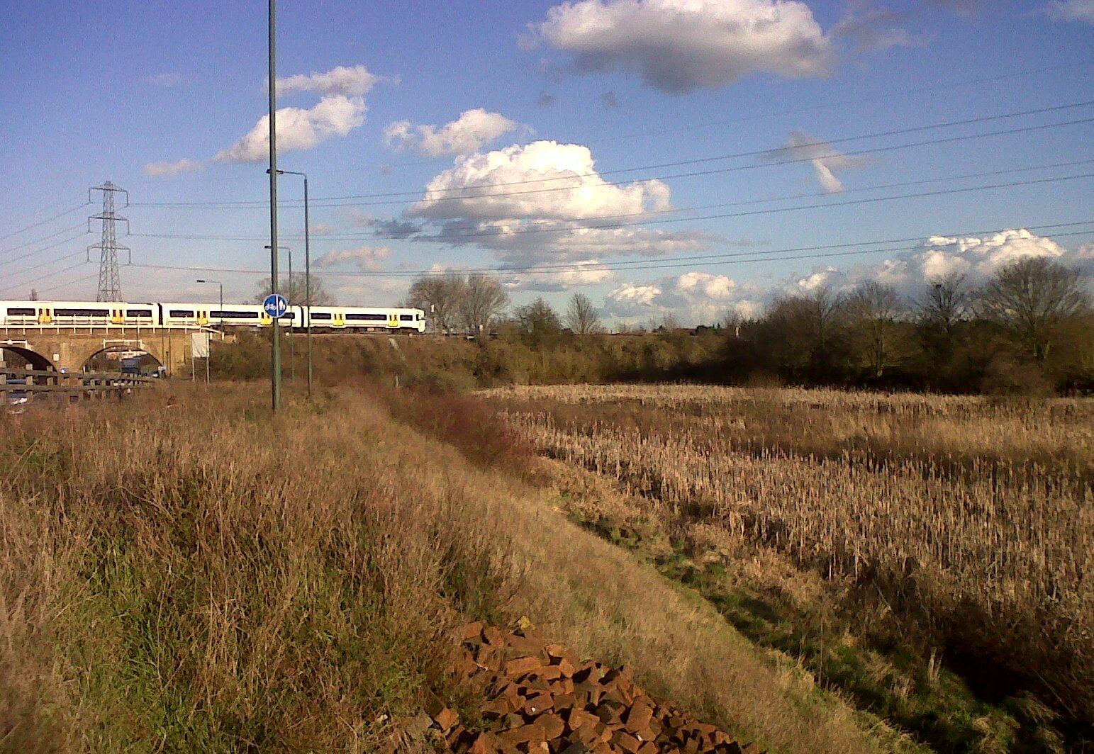
Very similar viewpoint 32 years later on March 3rd
2015. (Photo: Chris Rose).
Note the lack of trees and only a very few shrubs to the right of the car on the Sewer Pipe Embankment, and on the railway embankment, in the 1983 view. The site looks to have been suffering from over-grazing by Horses. It is presumed that a reduction in grazing by these animals, and perhaps by Rabbits, coupled with colonisation of the railway embankment by Elder and Buddleia, which Rabbits leave alone, took place at some later date. Meanwhile, there go some good old BR blue and grey slam-door 4-EPBs hurrying to and from Dartford. Those were the days …
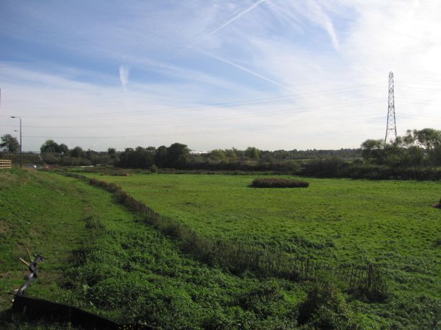
A similar view again, but from somewhat further from the railway line. Thought to have been taken in 2006 shortly before the wetland was created. (Photo: Rupert Cheeseman, Bexley Council).
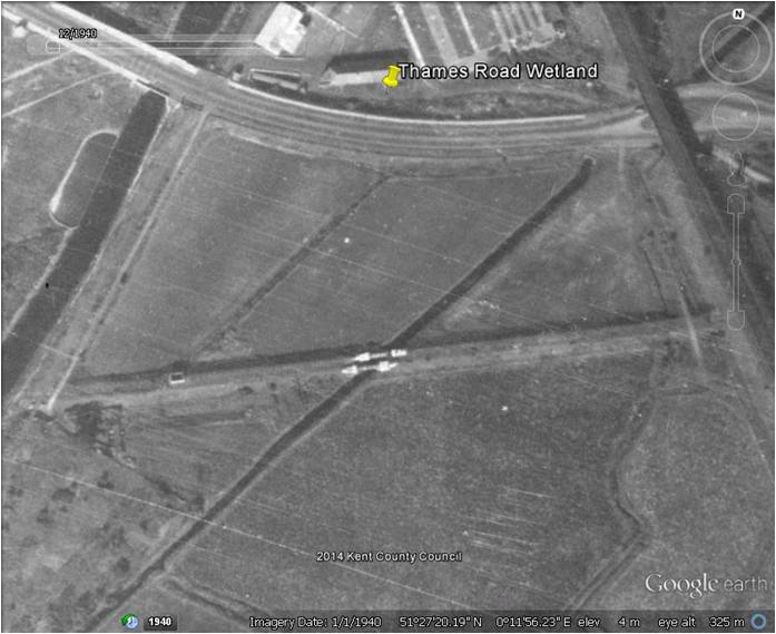
Google Earth image, said to have been taken in 1940.
In this wartime image the River Wansunt can clearly be seen cutting through the Sewer Pipe Embankment, with the pipe ‘bridge’ evident. There is a second drainage channel to the left, and another along the east margin of the site at the foot of the railway embankment. No trees or shrubs! The pathway over the east end of the Embankment is as evident today as it was then.